 |
|
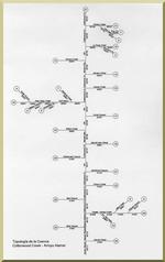
METHODOLOGY
Determination of the
topology of the drainage network.
Conversion of the
1:50,000-scale maps of the Mexican cartography (INEGI) to the 1:24,000 scale of United States
cartography (USGS).
Conversion of the data to the metric system.
Compilation of California precipitation data for return periods from 2 to 100 yr.
Extension of the precipitation data to return periods of 200, 500 and 1000 yr.
Selection of the SCS storm type I, applicable to Southern California.
Calculation of the maximum mean monthly levels in Morena and Barrett reservoirs.
Collection of cartographic data for soil type and land use in California.
Evaluation, using stereoscopic pairs, photographic mosaics and field visits, of the soil type and
land use conditions in the Mexican portion of the basin.
Evaluation of the average land slope
and average stream slope in the drainage network of Cottonwood Creek - Arroyo Alamar.
Evaluation of typical cross-sections.
Model runs for the 2-, 5-, 10-, 25-, 50-, 100-, 200-, 500-, and 1000-yr frequencies,
using the maximum average monthly level in Morena and Barrett reservoirs.
Model runs for the 2-, 5-, 10-, 25-, 50-, 100-, 200-, 500-, and 1000-yr frequencies,
assuming zero infiltration in the project channelization reach. This is
necessary to evaluate the impact of a postulated concrete channel on the aquifer recharge.
Use of RAINFLO, a hydrologic rainfall-runoff model
developed by the author to emulate the U.S. Army Corps of Engineers HEC-1 standard.
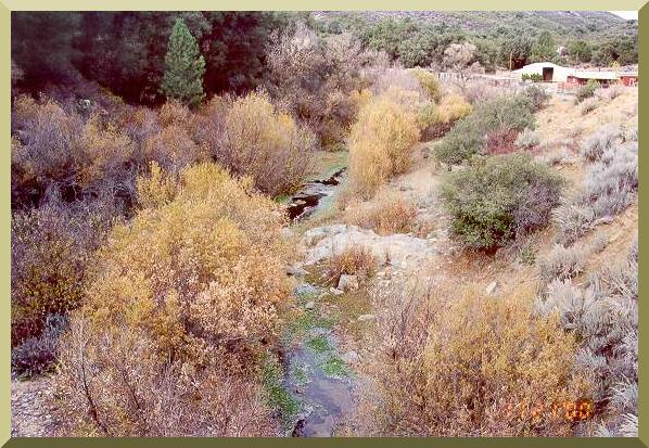 |
| Pine Valley Creek downstream of the bridge at Old Highway 80 |
DATA MANAGEMENT |
DESCRIPTION OF THE BASIN |
main page |