- The San Joaquin Valley is located in the Central Valley of California.
- The valley is drained naturally by the San Joaquin River, which flows first southwest and then northwest towards the Sacramento-San Joaquin Delta.
- The uplift of the Coastal Range has literally closed the valley and resulted in the creation of extensive flatlands.
- The southernmost portion of the San Joaquin valley encompasses the Tulare Lake Basin, which is drained by the Kings, Kaweah, Tule, and Kern rivers,
with no outlet to the ocean.
- The western half of the San Joaquin Valley suffers from insufficient drainage.
- A tight clay soil layer which underlies most of the land can cause water and salts to accumulate in the root zone.
- The flatlands contain arable land which is suitable for agriculture.
- Since 1960, the U.S. government has developed irrigation projects in the west San Joaquin Valley.
- The State of California completed the State Water Project (SWP) in 1968.
-
The SWP provides up to 1.3 million acre-feet of irrigation water to the southern San Joaquin valley, and up to 5.5 million acre-feet to Southern California.
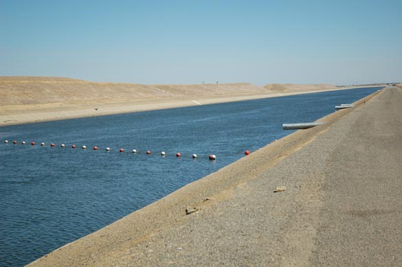
- The San Luis Canal was completed in 1968, assuring reliable water deliveries to the west San Joaquin Valley (Fig. 1).
Fig. 1 The San Luis Canal.
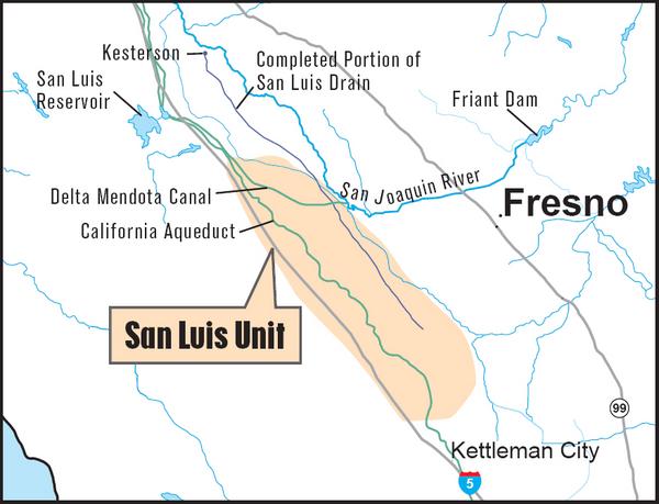
- Approximately 700,000 acres of land have been developed in the Central Valley Project's (CVP)
San Luis Unit and other projects in the vicinity (Fig. 2).
- Westlands Water District is the largest agency in charge of water deliveries in the region, providing water to 600 family-owned farms which average
850 acres in size. Other smaller water districts also deliver water to farms in the region.
- Farms within Westlands produce nearly $1 billion worth of food and fiber every year.
- The CVP's San Luis Unit guaranteed not only a reliable water supply for irrigation but also the drainage of the
irrigated lands.
- For this purpose, the San Luis Drain was proposed, to carry 300 cfs of agricultural
drainage waters, from the west side of the San Joaquin valley
to the point of delivery near the Sacramento-San Joaquin Delta.
- Some 42,000 acres of land were connected to the San Luis drain.
Fig. 2 Geographical location of San Luis Unit (Source: USBR).
- Water drained from the fields contain high concentration of salts, including sodium sulfate, sodium chloride, calcium sulfate, and calcium carbonate.
In addition, it has high concentrations of trace minerals, including selenium, arsenic, boron, and molybdenum.
- Construction of the San Luis Drain was started in 1968, and by 1975, 82 of the 188 planned miles had been constructed.
- At that time (1975), Congress ordered the U.S. Bureau of Reclamation
not to complete the San Luis Drain, over concerns that the return waters would pollute San Francisco Bay and the
Sacramento-San Joaquin Delta.
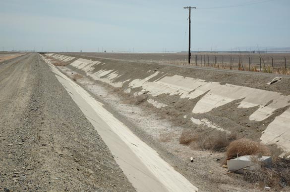
- With the drainage project halted, drainage water was placed into Kesterton reservoir, near the town of Gustine,
about 80 miles south of the Sacramento-San Joaquin Delta (Fig. 3).
Fig. 3 The abandoned San Luis Drain.
- In the late 1970s, the U.S. Fish and Wildlife Service took over the management of Kesterton as a wildlife refuge.
- In 1983, there were many documented cases of mortality and embryonic deformities among waterfowl in Kesterton Reservoir.
- Studies revealed that the water at Kesterton Reservoir has very high levels of selenium,
a naturally occurring element present in the drainage waters.
- Selenium is a micronutrient when its concentration is at trace level.
However, at large concentrations it is very toxic to both birds and humans.
- Acting upon the selenium contamination,
the U.S. government closed the San Luis Drain and Kesterton reservoir in 1986.
- The closure of the San Luis Drain effectively stopped drainage services to the west San Joaquin valley farmers.
- In the 1990s, landowners in the San Luis Unit sued the U.S.
Department of the Interior (Interior) requesting that it fulfill its obligation to provide drainage services to the
west San Joaquin valley.
- In 1995, the Federal District Court ordered Interior's Bureau of Reclamation (Reclamation) to provide drainage to the west San Joaquin valley, and ordered it
to complete a drain to the Delta.
- In 2000, upon appeal of that order, the 9th Circuit affirmed that Reclamation has a mandatory duty to provide drainage service to the
San Luis unit, but held that it had the discretion to provide
service other than through an interceptor drain to the Delta.
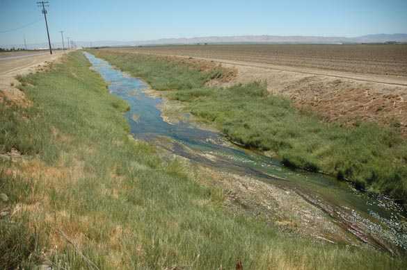
- Reclamation has determined that a total of 379,000 acres will require drainage service, with a total volume of 97,000 acre-ft per year (Fig. 4).
Fig. 4 Working drain in the San Joaquin valley.
- Additional measures at the farm level are estimated to reduce the total drainage output to 70,000 acre-ft per year.
- In 2005, Reclamation presented seven alternatives, ranging from Delta or ocean disposal to drainage flow reduction through land retirement.
-
Four alternatives provide drainage services to all 379,000 acres of land that require it.
These alternatives include Delta discharge at two locations, ocean disposal, and in-valley evaporation.
-
Three other alternatives combine in-valley evaporation with varying levels of land retirement.
These alternatives would cease irrigation on 92,000, 194,000, and 308,000 acres, reducing drainage production from 70,000 to 61,000, 45,000, and 27,000 acre-ft,
respectively (Fig. 5). Evaporation ponds, water treatment, and water reuse would also be part of the solution.
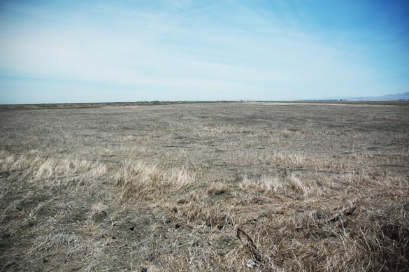
- The cost of the alternatives range from U.S. $589 million to $918 million. The least net-cost alternative is the retirement of 308,000 acres of land.
Fig. 5 Drainage-affected land in the San Joaquin valley.
- In March of 2007, Reclamation decided to pursue the In-Valley/Water Needs Land Retirement Alternative, which includes
drainage reduction measures, drainage water reuse facilities, treatment systems, evaporation ponds, and the retirement
of 194,000 acres of land from irrigated farming.
- The federal government plans to buy out the lands from the owners and retire them from agricultural use. The cost of the lands will be assessed as if the lands were fully under production and drainage had been implemented.
- The revised cost (2007) of providing drainage service for the In-Valley/Water Needs Land Retirement Alternative is U.S. $ 2.6 billion.
|