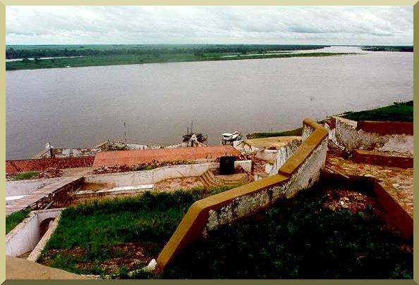
| View of the Paraguay river from Forte Coimbra, Mato Grosso do Sul. |
GEOGRAPHICAL BACKGROUND, PANTANAL AND HIDROVIA
| View of the Paraguay river from Forte Coimbra, Mato Grosso do Sul. |
|
This section establishes the geographical background for this study. It is divided into
four subsections:
This study focuses on the impact of the proposed Paraná-Paraguay waterway project on the Pantanal of Mato Grosso, which lies within the Paraguay river basin, a major tributary of the Paraná-Paraguay basin system. The reference sources for the information contained in this section are listed in Appendix 1. The figures and tables for all sections are included in Appendices 2 and 3, respectively.
2.1 The Paraná-Paraguay River BasinThe Paraná-Paraguay river basin is the most important of the La Plata basin system, in terms of both discharge (75 percent) and catchment area (84 percent) (Bonetto, 1975). The La Plata system is the second largest in South America, after the Amazon. The Paraná-Paraguay basin drains an extensive region encompassing 2605 000 km2 in Brazil, Argentina, Paraguay, and Bolivia. As its name indicates, it is composed of two major rivers: the Paraná and the Paraguay. The Paraná is the largest of the two, draining 1510 000 km2 (58 percent). The Paraguay river, draining the remaining 1095 000 km2, is the most important tributary of the Paraná. The geographical distribution of the Paraná river basin is the following: 59 percent in Brazil, 37.4 percent in Argentina, and 3.6 percent in Paraguay. The geographical distribution of the Paraguay river basin is: 33.4 percent in Brazil, 33.3 percent in Paraguay, 16.7 percent in Argentina, and 16.7 percent in Bolivia (Anderson et al, 1993). The combined Paraná-Paraguay river basin drains substantial portions of these four South American countries (Fig. 1). The Paraná river is divided into three sections (Bonetto, 1975):
2.2 The Paraguay and Upper Paraguay River BasinsThe headwaters of the Paraguay river basin are located in the Serra de Tapirapuã, in the proximity of Vila de Parecis, in the state of Mato Grosso, Brazil (EDIBAP, 1979). After flowing in a general southern direction for a distance of about 2800 km, the Paraguay river reaches the Paraná at Confluencia, north of the Argentinian cities of Corrientes and Resistencia (Fig. 1). The Paraguay river is divided into three sections (Anderson et al, 1993):
The Pilcomayo and Bermejo rivers, tributaries of the Middle and Lower Paraguay, respectively, descend from the Andes to the West (Fig. 1). Likewise, the eastern tributaries of the Middle and Lower Paraguay flow over hilly terrain. The rest of the Paraguay river basin comprises an immense inland plain, with extremely flat relief. This peculiar geomorphologic setting has led to the existence of the Pantanal of Mato Grosso, an extensive group of wetlands located wholly within the confines of the Upper Paraguay river basin (Tricart, 1982). The Upper Paraguay river is the upstream section of the Paraguay river, from its headwaters to the confluence with the Apa river. The latter marks the border between Brazil (to the north) and Paraguay (to the south). The Upper Paraguay river basin contains the Pantanal of Mato Grosso and its headwaters, wholly within Brazilian territory, and portions of Eastern Bolivia and Northwestern Paraguay. While the precise western limits of the basin are uncertain (the Bañados de Izogog, in Eastern Bolivia), the northern and eastern limits are delimited by mountain ranges, all within Brazil. To the East, the basin is limited by the Maracaju, Caiapó, and Saudade ranges; to the North by the Parecis range, and partly by the Azul range. The basin lies between 14o and 23o S, and 53o and 60o W (Fig. 2). The Upper Paraguay river basin comprises 496 000 km2, in two distinct regions (DNOS, 1974):
The principal tributaries of the Upper Paraguay river are (Fig. 2):
Other tributaries, primarily intermittent, include the Negro, Aquidabã, Branco, Tereré, and Amonguijá. All these are left-bank tributaries, located wholly within Brazil. For reference purposes, Table 1 shows selected hydrographic characteristics of the Upper Paraguay river. Table 2 shows selected hydrologic data at gaging stations along the Upper Paraguay river (Fig. 3). Table 3 shows valley slopes along the Upper Paraguay river and its major tributaries. Table 1 shows that the Upper Paraguay river is quite sinuous, particularly upstream of Corumbá, where the sinuosity, i.e., the ratio of river length to valley length, can be quite high. For instance, the reach from 40 km downstream of Porto Conceição to Refúgio das Três Bocas, where the sinuosity is: (161 km)/(55 km) = 2.92. The influence of sinuosity on proposed navigational improvements is analyzed in Section 4.1.1. Table 2 shows that the difference between maximum and minimum observed water levels along the Upper Paraguay river is smallest at Descalvados (2.61 m), remaining small (less than 3.5 m) for about 200 km downstream (at Porto Conceição it is 3.28 m; at Bela Vista do Norte it is 3.27 m). This indicates the presence of substantial channel overflows in the Upper Paraguay river between Descalvados and Bela Vista do Norte. Table 3 shows that valley slopes in the Upper Paraguay river basin decrease gradually, from 15-50 cm/km close to the mountains to the north, east, and south, to 7-15 cm/km along the major tributaries, and to 0.7-6.5 cm/km along the Upper Paraguay river. This reveals that the Upper Paraguay river constitutes a regional base level for the flow of its eastern tributaries.
2.3 The Pantanal of Mato GrossoThe Pantanal of Mato Grosso is a seasonally inundated depression wholly contained within the Upper Paraguay river basin, encompassing approximately 136 700 km2 (Projeto RADAMBRASIL, 1982a&b). The Pantanal is geomorphologically and hydrologically positioned to attenuate and reduce the runoff from the basin. Tricart (1982) has stated that the mountains to the south of the Pantanal "strangle" the valley of the Upper Paraguay river close to the location where it exits Brazilian territory. Significantly, this geomorphic feature is referred to locally as Fecho dos Morros, literally, "closing of the hills." (Fig. 3). The Pantanal is a huge natural reservoir receiving distributed inflows from the Upper Paraguay river and its tributaries, and concentrating runoff at the basin outlet, the Apa river confluence, about 100 km downstream of Fecho dos Morros. Large portions of the Pantanal are flooded only during the annual crest of the Upper Paraguay river and its tributaries, and much nonflooded terra firma is interspersed throughout the region. The mixture of permanent swamp, seasonal swamp, and nonflooded land, as well as the contiguity of the Pantanal to major South American biomes (the humid Amazon rainforest to the north and northwest, the subhumid savannas of Central Brazil to the east, the humid Atlantic forest to the southeast, and the semiarid scrub forest of neighboring Bolivia and Paraguay to the west and southwest) have conditioned the richness and variety of its vegetation and climate (Prance and Schaller, 1982). In turn, the Pantanal ecosystems support a rich and diverse fauna, including numerous species of mammals, reptiles, fish, birds, butterflies, and other invertebrates (Brown, 1986). The name Pantanal of Mato Grosso tends to hide the fact that the depression of the Upper Paraguay basin consists of not one but several seasonally flooded regions, quite distinct from each other; thus, the Portuguese name Planícies e pantanais matogrossenses, which stands for "Plains and swamps of Mato Grosso." The following pantanais were identified by Projeto RADAMBRASIL (1982a&b) (Fig. 4): Corixo Grande-Jauru-Paraguay, (2) Cuiabá-Bento Gomes-Paraguaizinho, (3) Itiquira-São Lourenço-Cuiabá, (4) Paiaguás, (5) Taquari, (6) Jacadigo-Nabileque, (7) Miranda-Aquidauana, (8) Negro, (9) Tarumã-Jibóia, (10) Aquibadã, (11) Branco-Amonguijá, and (12) Apa. Alternatively, Adámoli (1981) has classified the Pantanal of Mato Grosso into ten pantanais: (1) Cáceres, (2) Poconé, (3) Barão de Melgaço, (4) Paiaguás, (5) Nhecolândia, (6) Aquidauana, (7) Paraguay, (8) Miranda, (9) Nabileque, and (10) Abobral. The peculiar characteristics of the pantanais have led to the use of regional terminology to describe its most salient geomorphic features, namely baías, baixadas, barreiros, salinas, córregos, capões, cordilheiras, vazantes, and corixos. A brief description of each follows.
The characteristics of the several pantanais that constitute the Pantanal of Mato Grosso are described by Projeto RADAMBRASIL (1982a&b) and Silva (1986). The soils and inundation patterns (flooding levels) of the Pantanal are described by Projeto RADAMBRASIL (1982a&b) and Amaral Filho (1986).
2.4 The Paraná-Paraguay Waterway (Hidrovia) ProjectThe Paraná-Paraguay river basin system is an extensive region in South America, which lies within the countries of Argentina, Bolivia, Brazil, and Paraguay. The neighboring Uruguay river drains portions of Argentina, Brazil, and Uruguay. The confluence of these two rivers is near the city of Nueva Palmira, Uruguay (Fig. 1). The Paraná-Paraguay and Uruguay rivers are the major tributaries of the La Plata basin system. The Paraná-Paraguay basin is home to a population of almost 20 million people. For centuries, this river system has been used as a waterway for transportation. In February 1995, the IDB and the UNDP commissioned an eighteen-month series of engineering and environmental impact studies to evaluate potential navigational improvements to the exist ing waterway. This study includes the possibility of extensive engineering works to render 3442 km of the river navigable for ocean-going vessels, from Nueva Palmira to Cáceres, Brazil. Since the port of Cáceres is located upstream of the Pantanal of Mato Grosso, the short- and long-term impacts of the proposed navigational improvements on the Pantanal should be clearly established prior to project implementation. The project is commonly referred to as the Hidrovia project, since "Hidrovia" means waterway in both Spanish and Portuguese. The stated purposes of the Hidrovia project are to enhance current river transport via improvements to existing port, channel, and navigation facilities and to construct a year-round navigable waterway along the 3442 km. These efforts are being planned in two stages:
Phase 1 (Module A): Short-term interventionThis phase entails the improvement in navigational aids and the required river engi neering, including dredging and related works, along 80 percent of the proposed project's length. The affected region extends from the downstream port of Nueva Palmira, upstream to the port of Corumbá/Ladario, in Brazil, and neighboring Puerto Quijarro, in Bolivia.
Phase 2 (Module B): Medium- and long-term intervention
This phase entails the improvement in navigational aids and the required river
engineering, including dredging, channel modification, and other major river interventions,
along the entire length of the proposed project (3442 km), from Nueva Palmira to
Cáceres. The executive agency for the Hidrovia project is the Comité Intergubernamental de la Hidrovia (CIH) (Intergovernmental Committee of the Waterway), established in 1989 by the Ministers of Public Works and Transport of Argentina, Bolivia, Brazil, Paraguay, and Uruguay. The headquarters of the CIH is in Buenos Aires, Argentina. To date (1995), the only comprehensive document with enough detail on the Hidrovia project is the Internave report, commissioned by the extinct Empresa de Portos do Brasil (PORTOBRAS), and completed in 1990 by the Brazilian company of the same name (INTERNAVE, 1990). This report is basically an economic feasibility study of the Hidrovia project. As such, it uses projections of economic benefits to justify the costs involved in project implementation. The Internave report has been criticized for its overly optimistic projections of benefits (CEBRAC/ICV/WWF, 1994). The IDB has formally rejected the Internave study and will use the Phase 2 feasibility study, currently under execution, to recalculate cost and benefits (Lammers et al, 1994). However, the physical descriptions contained in the Internave report, which include channel straightening, dredging, blasting of rock outcrops and other structural interventions in the river, some of them irreversible, have remained the cause for significant concern among diverse segments of the local, national and international communities. These include environmental organizations, nongovernmental organizations (NGO's), professional associations, and universities and scientific research institutions in Brazil, the American continent, and the rest of the world. Channel straightening by realignment and cutoffs, dredging, and blasting of rocky sills are being considered to improve navigational conditions along the waterway. In particular, the Terms of Reference of the Phase 2 (Module B-1) engineering study, under Section 1-Purpose, states the following task (No. 4), among seven others (IDB, 1995, p. 2): |
| "The development of a preliminary project of alternatives to improve the conditions of the waterway, including dredging, blasting of rocky sills, channel straightening, stabilization of the navigation channel, regularization of the water resources, and any navigational structure that is considered pertinent." |
|
The extent of these interventions and their possible impact on the hydrologic regime of the Pantanal of Mato Grosso will be better known by the second half of 1996, once the ongoing studies are completed. The IDB has asserted that it may not fund the Hidrovia project through the Pantanal if serious environmental impacts are anticipated (Lammers et al, 1994). Thus, the present study is a contribution to the proper assessment and evaluation of these impacts. The Internave report lists the various geographic locations along the Hidrovia project, starting from the port of Buenos Aires (Km 0), progressing upstream to the port of Cáceres (Km 3 442). For reference purposes, an abstracted list of locations relevant to this study is shown in Table 4. Minor discrepancies between river distances in Tables 1 and 4 reflect the different sources for these tables: DNOS (1974) and INTERNAVE (1990).
|