 |
|
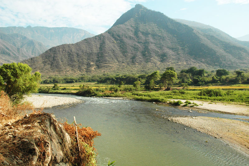
Fig. 1 Proposed damsite at |
LAMBAYEQUE, PERU
TASK 5: ENVIRONMENTAL IMPACT ASSESSMENT
PART 2: SECTION 4
June 29, 2009
Dr. Victor M. Ponce
Environmental Consultant
4. ENVIRONMENTAL CHARACTERIZATION
The environmental characterization consists of a description of the physical, biological, and human resources settings in connection with the
proposed project and its environs.
The physical setting includes a description of the topographic relief, geomorphology, geology, hydrology, archaeological remains, water quality,
air quality, noise, and hazardous residues.
The biological setting includes a description of ecosystems, habitats, migration, natural reserve areas, human populations, flora and fauna, flooding areas,
swamps and wetlands, and endangered species.
The human resources setting includes demography, economy and development, land use, infrastructure, housing, schools, health care, transportation,
fishing, recreation, public services, and archaeological and historical resources.
These settings are described in detail in the following sections of this report.
4.1 Physical setting
The La Leche river basin is located in the western slopes of the Western Range of the Peruvian Andes,
in the departments of Lambayeque and Cajamarca, in northern Peru.
The La Leche river is a tributary of the Motupe river, which drains the western slopes of the
mountains immediately north of the La Leche river basin.
Downstream of its confluence with the La Leche river, the Motupe river flows in a general western direction,
discharging into the La Niña Lake, without an outlet to the sea.
The La Leche river basin has three distinct sections: (1) from
headwaters to the natural geologic constriction at La Calzada,
with a drainage area of 907 km2; (2) from La Calzada to Huaca de La Cruz,
with a drainage area of 634 km2; and (3) from Huaca de La Cruz to the confluence with the Motupe river,
with a drainage area of 175 km2. Thus, the total drainage area of the La Leche river is 1,716
km2.
The headwaters of the La Leche river are at Cerro Choicopico, at an elevation of 4,230 m above mean sea level. The La Leche river to La Calzada
has three major tributaries: (1) Moyan River, (2) Sangana River, and (3) Cincate Creek. These tributaries contribute the following volumes
to the flood peak at La Calzada: (1) Moyan River, 27.3%; (2) Sangana River, 43.6%; and (3) Cincate Creek, 16.6%, for a total of 87.5%.
The remaining flood volume (12.5%) is accounted for by the lateral contributions of the La Leche river proper, downstream of the confluence
of the Moyan and Sangana rivers (Ponce, 2008).
The Huaca de La Cruz sector has archaeologically and ecologically sensitive areas. Thus, the proposed dam and reservoir are located
further upstream, at La Calzada, far from the sensitive areas.
The neighboring Chancay river to the south also drains the western slopes.
During extreme floods, the drainage basins of the La Leche and Chancay rivers overlap along their low-flow boundary.
Thus, the La Leche river can overflow into the Chancay river in times of extreme flood, further confusing the issue of drainage.
The towns of Illimo, Pacora, and Jayanca, are located on the flood plain of the La Leche and Motupe rivers.
4.2 Biological setting
The biological setting comprises a description of the ecosystems, flora and fauna, habitats, migration, natural reserve areas,
swamp and wetland areas, and endangered species.
4.2.1 Ecosystems
The ecosystems in the project area and vicinity can be divided into three groups:
The floodplain ecosystems are represented in the middle reaches of the La Leche river valley,
from the Bosque de Pomac (Pomac Forest), moving upstream to Rinconada Calicantro (Calicantro side valley),
extending south as far as Matriz Comunidad, and northeast up to Motupillo. This ecosystem is
represented by the following woody species:
In Calicantro, a few specimens of guayacán (Guaiacum officinale) and Palo Blanco (Calycophyllum multiflorum) remain.
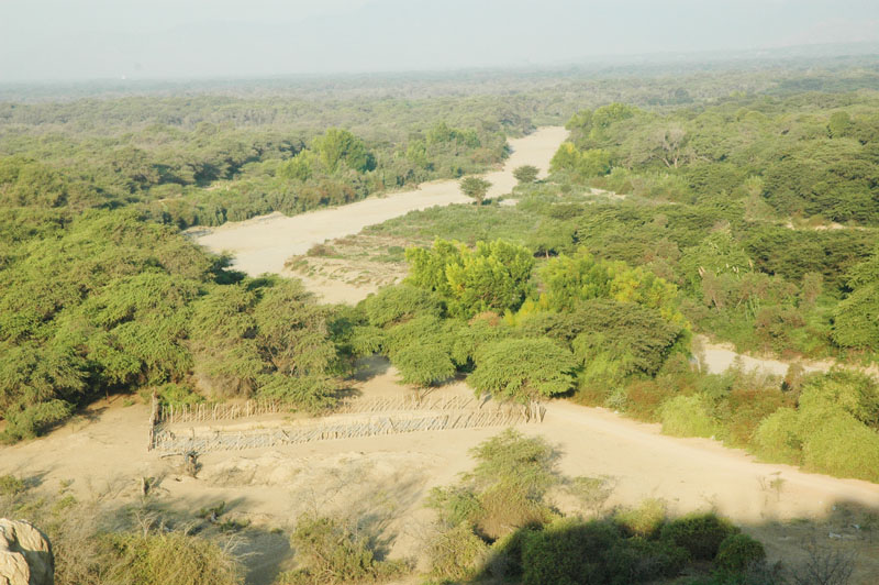 |
| Fig. 4 Floodplain ecosystem of the Pomac Forest, with La Leche river in the foreground. |
The representative fauna of the floodplain ecosystems are the following:
- Birds, such as
- pale-legged hornero [chilala] (Furnarius leucopus),
- long-tailed mockingbird [chisco, calandria colilarga] (Mimus longicaudatus),
- Peruvian plantcutter [cortarrama] (Phytotoma raimondii),
- Tumbes swallow [golondrina de Tumbes] (Tachycineta stolzmanni),
- Tumbes tyrant [tirano de Tumbes] (Tumbezia salvini),
- Rufous flycatcher [copetón rufo] (Myiarchus semirufus),
- red breast [peche rojo] (Sturnella loyca),
- rock pigeon [paloma] (Columba livia),
- gray heron [garza real] (Ardea cinerea), and
- woodpecker [pajaro carpintero] (Picumnus lafresnayi).
(a)
(b)
(c)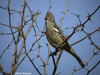
(d)
(e)
(f)
Fig. 5 (a) pale-legged hornero (Furnarius leucopus), (b) long-tailed mockingbird (Mimus longicaudatus),
(c) Peruvian plantcutter (Phytotoma raimondii), (d) Tumbes tyrant (Tumbezia salvini),
(e) Rufous flycatcher (Myiarchus semirufus), and (f) woodpecker (Picumnus lafresnayi)
(Sources: Google and Wikipedia). - Reptiles, such as
- Coral snake [coralillo] (Micrurus tschudii),
- Iguana lizard [iguana] (Iguana iguana), and
- Leopard lizard [pacaso] (Callopistes flavipunctatus).
(a)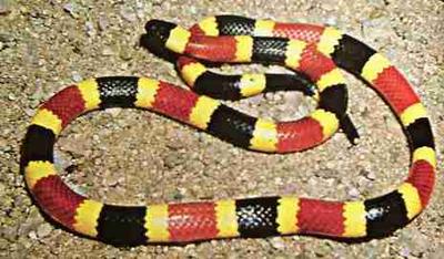
(b)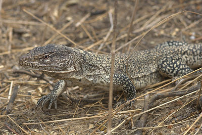
Fig. 6 (a) coralillo (Micrurus tschudii), and (b) pacaso (Callopistes flavipunctatus) (Source: Google). - Mammals, such as
- squirrel [ardilla] (Spermophilus lateralis),
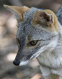
- Peruvian desert fox [zorro costeño peruano] (Pseudalopex sechurae),
- Northern anteater [oso hormiguero] (Tamandua mexicana),
- white-tailed deer [venado cola blanca] (Odocoileus virginianus),
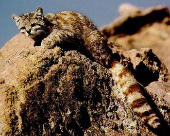
- Andean mountain cat [gato montés andino] (Leopardus jacobitus),
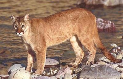
- cougar, or mountain lion [puma] (Puma concolor), and
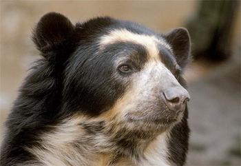
- spectacled bear [oso de anteojos] (Tremarctos ornatus).
|
| ||
|
|
|
Fig. 7 (a) Peruvian desert fox (Pseudalopex sechurae), (b)
white-tailed deer (Odocoileus virginianus), (c) Andean mountain cat (Leopardus jacobitus), and (d) spectacled bear (Tremarctos ornatus) (Sources: Google and Wikipedia). |
The semideciduous hilly ecosystems are represented in the upper reaches of the La Leche river valley, from Rinconada Calicantro to El Higueron, in the vicinity of Puente Caído, near the confluence of the Moyán and Sangana rivers [to form the La Leche river]. It includes the hills of Motupillo, La Traposa, Calaboso, and La "U" on the left margin, and Calicantro, Huaca Rajada, La Calera, and Negrahuasi on the right margin.
This ecosystem is represented by the following woody species:
- South American Sapote [sapote] (Capparis angulata),
- carob tree [huarango, algarrobo americano] (Prosopis pallida),
- Peruvian cactus [cactácea columnar] (Neoraimondia arequipensis),
- melon cactus [cactácea ovoide] (Melocactus sp.),
- pearlberry [cuncuno] (Vallesia glabra),
- caper bush [vichayo] (Capparis ovalifolia), and
- guava tree [overo] (Cordia lutea).
 |
| Fig. 8 Semideciduous hilly ecosystem in the upper reaches of the La Leche river valley. |
The representative fauna of the semideciduous hilly ecosystems are the following:
- Birds, such as
- pale-legged hornero [chilala] (Furnarius leucopus),
- long-tailed mockingbird [chisco, calandria colilarga] (Mimus longicaudatus),
- red breast [peche rojo] (Sturnella loyca),
- rock pigeon [paloma] (Columba livia),
- gray heron [garza real] (Ardea cinerea), and
- woodpecker [pajaro carpintero] (Picidae sp.).
- Reptiles, such as the coral snake [coralillo] (Micrurus tschudii), and
- Mammals, such as
- squirrel [ardilla] (Spermophilus lateralis),
- Peruvian desert fox [zorro costeño peruano] (Pseudalopex sechurae),
- white-tailed deer [venado cola blanca] (Odocoileus virginianus),
- Andean mountain cat [gato montés andino] (Leopardus jacobitus),
- cougar, or mountain lion [puma] (Puma concolor), and
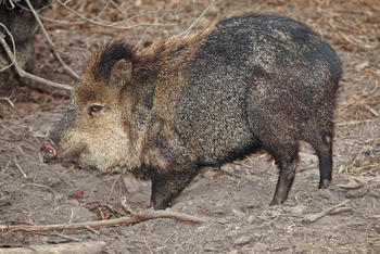
- collared peccary [pecarí de collar, or sajino] (Tayassu tajacu).
|
|
| Fig. 9 (a) mountain lion (Puma concolor), and (b) collared peccary (Tayassu tajacu) (Source: Wikipedia). |
The relict montane ecosystems are represented from El Higuerón towards Moyán in the Moyán watershed, and towards Tocmoche in the Sangana watershed. It includes the hills of Lajas, Lajas de Tongón, Reloj, Naranjos, Machete, and Nuevo Mundo in the Moyán watershe; and Lajas de Tongón, Pampa de la Mula, Zapallar, Cruz Verde and Gallo in the Sangana watershed.
This ecosystem is represented by the following woody species:
- Horse-eye bean, ormosia [huayruro] (Ormosia coccinea),
- Guayacan [guayacán] (Guaiacum officinale),
- Fig tree [higuerón] (Ficus cotinifolia),
- Sandbox tree [catahua] (Hura crepitans),
- Peruvian cactus [cactácea columnar] (Neoraimondia arequipensis),
- melon cactus [cactácea ovoide] (Melocactus sp.),
- strawberry pear [pitahaya] (Hylocereus undatus),
- lipstick tree [achiote] (Bixa Orellana),
- balsa tree [palo de balsa] (Ochroma pyramidale), and
- Andean walnut [nogal andino] (Juglans neotropica).
 |
| Fig. 10 Relict montane ecosystem in the lower reaches of the Moyán watershed. |
The representative fauna of the relict montane ecosystems are the following:
- Birds, such as
- pale-legged hornero [chilala] (Furnarius leucopus),
- red breast [peche rojo] (Sturnella loyca),
- rock pigeon [paloma] (Columba livia),
- gray heron [garza real] (Ardea cinerea),
- woodpecker [pajaro carpintero] (Picidae sp.),
- mountain parakeet [lorito montano verde esmeralda] (Psilopsiagon aurifrons), and
- white-winged guan [pava aliblanca] (Penelope albipennis).
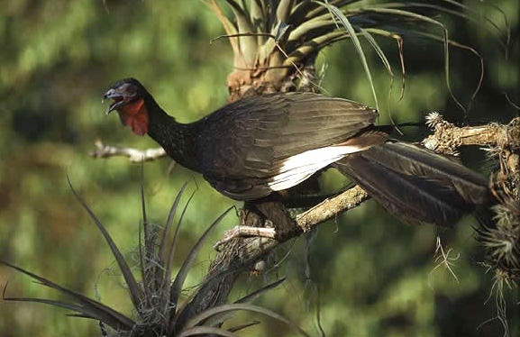
Fig.11 White-winged guan (Penelope albipennis)
(Source: Google). - Reptiles, such as the coral snake [coralillo] (Micrurus tschudii), and
- Mammals, such as
- squirrel [ardilla] (Spermophilus lateralis),
- Peruvian desert fox [zorro costeño peruano] (Pseudalopex sechurae),
- white-tailed deer [venado cola blanca] (Odocoileus virginianus),
- Andean mountain cat [gato montés andino] (Leopardus jacobitus),
- cougar, or mountain lion [puma] (Puma concolor), and
- collared peccary [pecarí de collar, or sajino] (Tayassu tajacu).
The La Calzada reservoir site is located at the confluence of the La Leche river with Quebrada Cincate (or Colán), near the hamlet of Mochumi Viejo. The site, currently subject to intensive farming, would be flooded by the reservoir.
 |
| Fig. 12 La Calzada reservoir site. |
The Calicantro reservoir site is located at Rinconada Calicantro, immediately north of the La Leche river, about 11 km downstream of La Calzada. The landscape consists of a broad alluvial plain flanked by the Calicantro and Hualtaco hills to the east and west, respectively. (The latter has been named here Hualtaco due to the prevailing presence of this tree species). Calicantro hill peaks at 411 m, and Hualtaco hill peaks at 475 m. The Jahuay Negro and San Antonio hills enclose the Calicantro valley to the north. The quebrada or wash that drains the Calicantro valley into the La Leche river is Quebrada Hualtacal.
The characteristic floristic associations in Calicantro are the following:
- South American Sapote [zapote] (Quararibea cordata) with guava tree [overo] (Cordia lutea) [zapotal-overal],
- Carob tree [algarrobo] (Prosopis pallida) with caper bush [vichayo] (Capparis ovalifolia) [algarrobal-vichayal], and
- Spruce hualtaco [hualtaco] (Loxopterygium huasango) with Peruvian sage or Holy Wood [huayacán, or palo santo] (Guaiacum officinale) [hualtacal-palo santo].
 |
| Fig. 13 The Calicantro damsite. |
The hualtacal-palo santo association is prevalent on the surrounding hills, achieving its maximum density toward the northwest of the valley. Also found are the Mexican palo verde, or jellybean tree (Parkinsonia aculeata, or Cercidium praecox) and the Peruvian cactus [cactácea columnar] (Neoraimondia arequipensis), with an occasional presence of the white copal tree [copal blanco, or papelillo] (Bursera jorullense).
 |
| Fig. 14 A hualtaco (Loxopterygium huasango) on the side hills of the Calicantro valley. |
The representative fauna of the Calicantro valley are the following:
- Birds, such as
- Vulture [buitre, or gallinazo] (Coragyps atratus),
- aplomado falcon [halcón aplomado] (Falco femoralis),
- common black-hawk [gavilán] (Buteogallus sp.),
- red-tailed hawk [guaraguao colirrojo] (Buteo jamaicensis),
- white-edged oriole [chiroque] (Icterus graceannae),
- red-crown parrot [loro de cabeza roja] (Amazona viridigenalis), and
- mountain parakeet [lorito montano verde esmeralda] (Psilopsiagon aurifrons).
(a)
(b)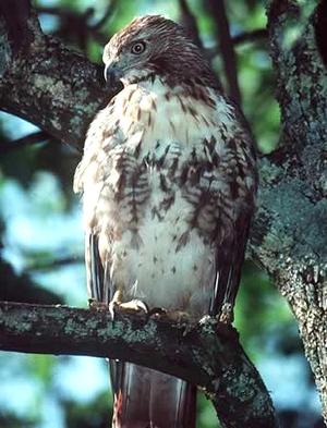
(c)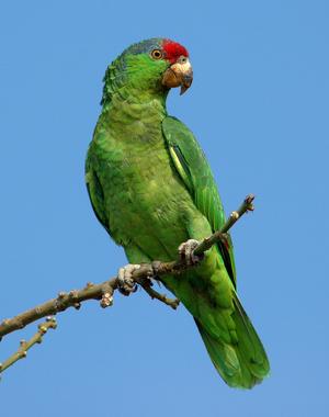
(d)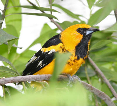
Fig.15 (a) Aplomado falcon (Falco femoralis), (b) Red-tailed hawk (Buteo jamaicensis),
(c) red-crown parrot (Amazona viridigenalis), and (d) White-edged oriole (Icterus graceannae)
(Source: Wikipedia and Google). - Reptiles, such as
- Coral snake [coralillo] (Micrurus tschudii), and
- Iguana lizard [iguana] (Iguana iguana)
- Mammals, such as
- Peruvian desert fox [zorro costeño peruano] (Pseudalopex sechurae),
- white-tailed deer [venado cola blanca] (Odocoileus virginianus),
- Andean mountain cat [gato montés andino] (Leopardus jacobitus),
- cougar, or mountain lion [puma] (Puma concolor),
- collared peccary [pecarí de collar, or sajino] (Tayassu tajacu),
- opossum [comadreja] (Didelphis marsupialis),
- Northern anteater [oso hormiguero] (Tamandua mexicana), and
- spectacled bear [oso de anteojos] (Tremarctos ornatus).
A special anthropogenic feature of the Calicantro valley is the ancient wall or parapet, of height that may have reached 3 m in the past, which extends across the lower valley in a direction perpendicular to the prevailing drainage. The wall continues on the hills, particularly on Hualtaco hill, suggesting a defensive purpose. The planned Calicantro reservoir would flood the wall and result in its disappearance.
4.2.2 Habitats
The study area has the following distinct habitats:
- Floodplain habitat (Hfp),
- Riparian habitat (Hr),
- Hilly habitat (Hh),
- Fiord habitat (Hf),
- Montane habitat (Hm), and
- Rupicola habitat (Hrp).
The representative fauna is that corresponding to a dry tropical forest.
The floodplain habitat is present in the floodplain of the La Leche river. The floodplain forests consist of understorey and tall canopy [umbral], with characteristic xerophytic vegetation. The understorey contains grasses and several shrubs, among them, the caper bush [vichayo] (Capparis ovalifolia), the pearlberry [cuncuno] (Vallesia glabra), and the guava [overo] (Cordia lutea). Reptiles and mammals inhabit the understorey, and its soil supports numerous bird species. The lianas ascend to the top of the algarrobo trees, forming dense cupulas.
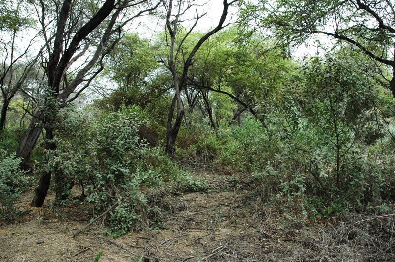 |
| Fig. 16 Floodplain habitat: the Pomac Forest. |
The riparian habitat is present along the banks of the La Leche river and its tributaries. It contains species that satisfy their evapotranspiration needs by pumping water from the ground. The elements of this habitat, also referred to as "gallery forest," are characteristically tall and evergreen. A typical specimen is the weeping willow (Salix xsepulcralis).
 |
| Fig. 17 Riparian habitat on the left bank of La Leche river at Pomac Forest, with a weeping willow (Salix xsepulcralis) in the foreground. |
The hilly habitat is present in hilly areas, where terrain slopes are greater than 10 percent. The predominant vegetation is represented by xerophytic shrubs and the cactaceae family, among them, notably, the Peruvian cactus [cactácea columnar] (Neoraimondia arequipensis).
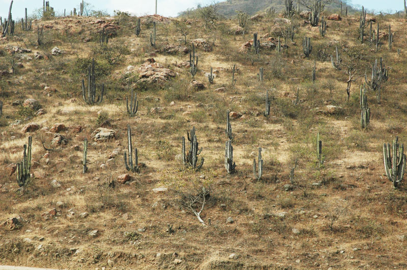 |
| Fig. 18 Hilly habitat adjoining the La Leche river valley downstream of La Calzada. |
The fiord habitat is present in specific areas, where the local geomorphology is conducive to greater soil moisture, resembling the fiords of the countries of the Northern Hemisphere. The representative species are bromelias, cactaceae, and pitahayas.
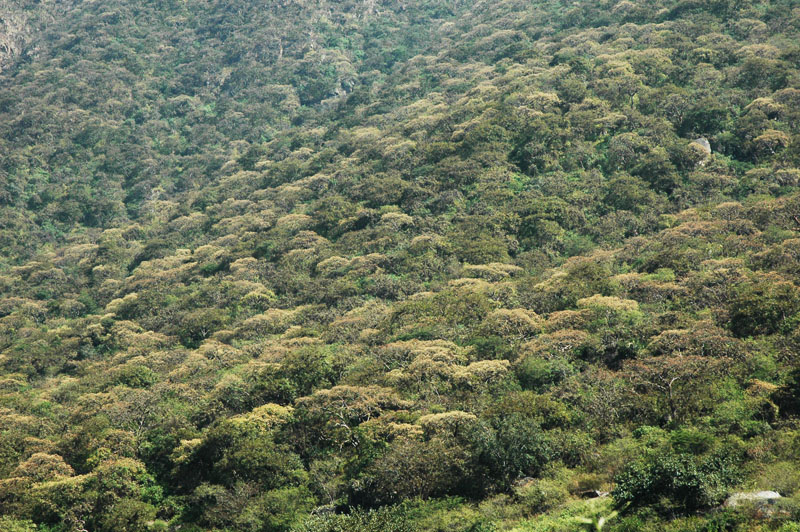 |
| Fig. 19 Fiord habitat in the Moyan watershed. |
The montane habitat is present in areas with mountainous relief, where terrain slopes are greater than 30 percent. Precipitation is spread more or less evenly throughout the year; consequently, the relative humidity is high. The representative species are bromelias, orchids, and prostrate ferns, which find support on the larger tree canopy.
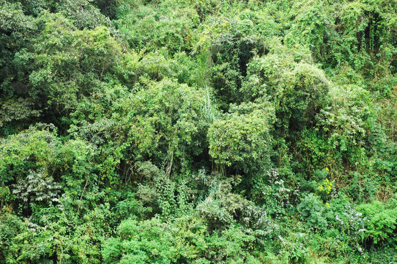 |
| Fig. 20 Montane habitat in the Moyan watershed near Cerro Reloj. |
The rupicola habitat is restricted to the top or side of rocks, or rocky terrain, or in areas with vertical terrain slopes, where the soil substrate is almost nonexistent. This is the habitat of the bromelias (Bromelia sp.), the strawberry pear [pitahaya] (Hylocereus undatus), and other small shrubs.
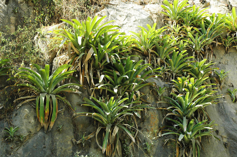 |
| Fig. 21 Rupicola habitat in the Moyan watershed near Cerro Lajas, showing a group of bromelias in the foreground. |
4.2.3 Migration
Faunal migration is related to the spatial and temporal variation of the seasons,
since climate significantly influences the vegetative cycles.
During droughts, the fauna migrates from the drier to the wetter ecosystems, i.e., from the hilly to the montane, looking for food and water.
Likewise, El Niño events, and its related La Niña, also produce faunal migrations.
The megafauna is the most dynamic of all.
The spectacled bear moves into Rinconada Calicantro, changing its diet to feed on local cattle.
The mountain cats, deer, foxes, anteaters, parrots, and guan [pava aliblanca] also move around following food (fruits) and water.
The birds ascend from the floodplain to the hills.
The reptiles remain or move where solar radiation is optimal.
For instance, the iguanas and pacasos do not ascend to the montane ecosystems, because of their lower temperatures.
4.2.4 Natural reserve areas
The natural reserve areas of the La Leche basin are the following:
The Historic Sanctuary of the Pomac Forest is located in the floodplain ecosystem surrounding the La Leche river in its lower course, at a mean
elevation of 80 m above mean sea level.
The sanctuary was created on June 3, 2001.
It occupies an area of 5,887 ha in the province of Ferreñafe, department of Lambayeque.
The sanctuary includes several ancient ceremonial sites, of rich archaeological value. These sites have been traced
to the Sicán culture, which inhabited the area starting in 750 A.D., and reached its maximum splendor in the period 900-1100 A.D.
The edifications, known locally as "huacas," comprise more than twenty (20) pyramids of adobe and mud, covering an area of
45 km2.
Notably among the huacas are Botija, Colorada, Ingenieros, Loro (El Oro), Merced, Sontillo, Abejas, Ventanas, Rodillona, and El Mirador.
The Pomac sanctuary houses a very dense dry tropical forest, featuring xerophytic trees, notably the carob tree [algarrobo]
(Prosopis pallida), the South American sapote [sapote] (Capparis angulata), and the
acacia [faique] (Acacia macracantha), together with shrub associations of
pearlberry [cuncuno] (Vallesia glabra),
caper bush [vichayo] (Capparis ovalifolia),
guava [overo] (Cordia lutea) and
chaquiro [chaquiro] (Pithecellobium excelsum),
in association with the strawberry tree [cerecillo] (Muntingia calabura).
 |
| Fig. 22 The Pomac Forest, with an ancient pyramid (huaca) to the left and La Leche river to the right (photo taken from Huaca El Mirador). |
Four distinct vegetal units have been identified in the Pomac forest:
- A Propopis forest, where the carob tree predominates over the sapote (more than 90 percent carob),
- A Prosopis-Capparis forest, where the carob and sapote trees coexist more or less on equal terms,
- A Capparis forest, where the sapote tree predominates over the carob (more than 70 percent sapote), and
- A chaparral forest, in marginal areas transitional to the adjoining desert.
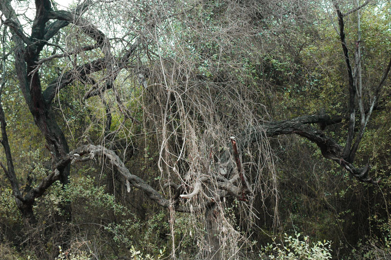 |
| Fig. 23 Inside the Pomac Forest. |
The Wildlife Refuge of Laquipampa is located in a premontane and montane zone of the La Leche river basin, with maximum altitudes of 2,800 m above mean sea level. The refuge was created on July 11, 2006, with aim to conserve a representative sample of the dry tropical montane forest and to protect the habitat of endemic species such as the white-winged guan [pava aliblanca] (Penelope albipennis). It occupies an area of 8,328 ha in the district of Incahuasi, province of Ferreñafe, department of Lambayeque. The reserve area begins at Higueron, near the confluence of the Moyan and Sangana rivers, and follows the course of the Moyan, upstream up to the hamlet of Laquipampa, at 900 m elevation.
The representative flora of the refuge are the following tree species: Peruvian sage or Holy wood [palo santo] (Bursera graveolens), Jamaican cherry [cerecillo] (Muntingia calabura), Spruce hualtaco [hualtaco] (Loxopterygium huasango), pasayo [pasayo] (Eryotheca ruizii), strangler ficus [higuerón] (Ficus nymphaeifolia), palo blanco [palo blanco] (Celtis triflora), maloxo [angolo] (Pithecellobium multiflorum), frejolillo [huayrul] (Erythrina smithiana). Typical shrubs are the guava tree [overo] (Cordia lutea) and brave cane [caña brava] (Ginerium sagittatum). Cactaceae include the Peruvian cactus [cactácea columnar] (Neoraimondia arequipensis) and the melon cactus [cactácea ovoide] (Melocactus sp.). The area features island hills, such as Cerro Lajas de Tongon and Cerro Nuevo Mundo, and several important colluvia.
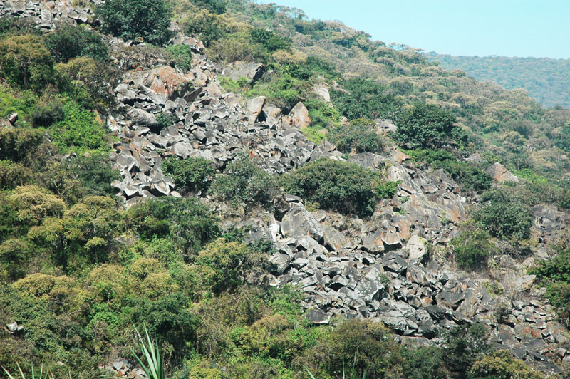 |
| Fig. 24 Active colluvium in the Laquipampa refuge. |
The wildlife refuge protects the habitat of the white-winged guan [pava aliblanca] (Penelope albipennis), which had been listed as critically endangered (CE). It is also the habitat of the spectacled bear [oso de anteojos] (Tremarctos ornatus), the Northern anteater [oso hormiguero] (Tamandua mexicana), the Andean mountain cat [gato montés andino] (Leopardus jacobitus), the mountain lion [puma] (Puma concolor), and the dynamic collared peccary [sajino] (Tayassu tajacu), which always roam in large groups.
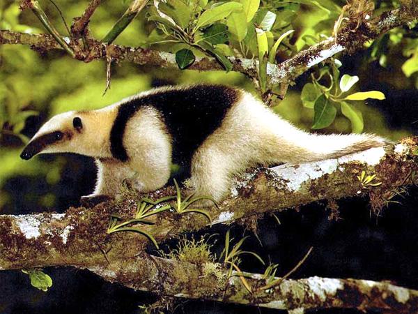 |
| Fig. 25 Northern anteater (Tamandua mexicana) (Source: Google). |
4.2.5 Swamp and wetlands
The study area is transversed by the Moyan and Sangana rivers, which join to form the La Leche river. These rivers are all perennial.
The Laquipampa refuge features a few waterfalls (Catarata Lajas).
The entire drainage basin is exorheic, with absence of significant swamps and wetlands.
4.2.6 Endangered species
The International Union for Conservation of Nature (IUCN) publishes the "Red List of Threatened Species" (2009.1)
(http://www.iucmredlist.org). The list divides species in seven extinction risk categories:
The threatened categories are VU, EN, and CE, as shown in Fig. 26. Table 1 lists the conservation status of faunal species identified in this study.
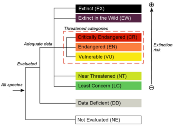 |
| Fig. 26 Extinction risk and threatened categories (Source: IUCN). |
| Table 1. Conservation status of faunal species identified in this study. | ||||
| Class | Common name | Local name(s) | Scientific name | Status |
| Birds | white-winged guan | pava aliblanca | Penelope albipennis | CR [5] |
| Peruvian plantcutter | cortarrama | Phytotoma raimondii | EN [4] | |
| Rufous flycatcher | copetón rufo | Myiarchus semirufus | EN [4] | |
| red-crown parrot | loro de cabeza roja | Amazona viridigenalis | EN [4] | |
| Tumbes tyrant | tirano de Tumbes | Tumbezia salvini | NT [2] | |
| pale-legged hornero | chilala | Furnarius leucopus | LC [1] | |
| long-tailed mockingbird | calandria colilarga, chisco | Mimus longicaudatus | LC [1] | |
| Tumbes swallow | golondrina de Tumbes | Tachycineta stolzmanni | LC [1] | |
| red breast | peche rojo | Sturnella loyca | LC [1] | |
| rock pigeon | paloma | Columba livia | LC [1] | |
| gray heron | garza real | Ardea cinerea | LC [1] | |
| woodpecker | pajaro carpintero | Picumnus lafresnayi | LC [1] | |
| mountain parakeet | lorito montano verde esmeralda | Psilopsiagon aurifrons | LC [1] | |
| Vulture | buitre | Coragyps atratus | LC [1] | |
| aplomado falcon | halcón aplomado | Falco femoralis | LC [1] | |
| Common black-hawk | gavilán | Buteogallus anthracinus | LC [1] | |
| red-tailed hawk | guaraguao colirrojo | Buteo jamaicensis | LC [1] | |
| white-edged oriole | chiroque | Icterus graceannae | LC [1] | |
| Reptiles | Coral snake | coralillo | Micrurus tschudii | NE [0] |
| Iguana lizard | iguana | Iguana iguana | NE [0] | |
| Leopard lizard | pacaso | Callopistes flavipunctatus | NE [0] | |
| Mammals | spectacled bear | oso de anteojos | Tremarctos ornatus | VN [3] |
| Peruvian desert fox | zorro costeño peruano | Pseudalopex sechurae | NT [2] | |
| squirrel | ardilla | Spermophilus lateralis | LC [1] | |
| Northern anteater | oso hormiguero | Tamandua mexicana | LC [1] | |
| white-tailed deer | venado cola blanca | Odocoileus virginianus | LC [1] | |
| mountain lion | puma | Puma concolor | LC [1] | |
| opossum | comadreja | Didelphis marsupialis | LC [1] | |
| Andean mountain cat | gato montés andino | Leopardus jacobitus | NE [0] | |
| collared peccary | pecarí de collar, sajino | Tayassu tajacu | NE [0] | |
| Table 2. Conservation status of floral species identified in this study. | ||||
| Class | Common name | Local name(s) | Scientific name | Status |
| Trees | Peruvian sage or Holy Wood | huayacán, or palo santo | Guaiacum officinale | EN [4] |
| Andean walnut | nogal andino, cedro grande | Juglans neotropica | EN [4] | |
| carob tree | huarango, algarrobo americano | Prosopis pallida | NE [0] | |
| South American Sapote | sapote | Capparis angulata | NE [0] | |
| acacia, or porknut | faique | Acacia macracantha | NE [0] | |
| Jamaican cherry, or strawberry tree | cerecillo | Muntingia calabura | NE [0] | |
| weeping willow | sauce llorón | Salix xsepulcralis | NE [0] | |
| Spruce hualtaco | hualtaco | Loxopterygium huasango | NE [0] | |
| Horse-eye bean, ormosia | huayruro | Ormosia coccinea | NE [0] | |
| Strangler fig | higuerón | Ficus cotinifolia | NE [0] | |
| Sandbox tree | catahua | Hura crepitans | NE [0] | |
| lipstick tree | achiote | Bixa Orellana | NE [0] | |
| balsa tree | palo de balsa | Ochroma pyramidale | NE [0] | |
| Mexican palo verde, or jellybean tree | palo verde | Parkinsonia aculeata, or Cercidium praecox | NE [0] | |
| white copal tree | copal blanco, papelillo | Bursera jorullense | NE [0] | |
| pasayo | pasayo | Eryotheca ruizii | NE [0] | |
| palo blanco | palo blanco | Calycophyllum multiflorum | NE [0] | |
| maloxo | angolo | Pithecellobium multiflorum | NE [0] | |
| frejolillo | huayrul | Erythrina smithiana | NE [0] | |
| Shrubs | yellow cordia | overo | Cordia lutea | NE [0] |
| caper bush | vichayo | Capparis ovalifolia | NE [0] | |
| pearlberry | cuncuno | Vallesia glabra | NE [0] | |
| chaquiro | chaquiro | Pithecellobium excelsum | NE [0] | |
| chope | chopé | Gustavia iquitosensis | NE [0] | |
| Cactaceae | Peruvian cactus | cactácea columnar | Neoraimondia arequipensis | NE [0] |
| strawberry pear | pitahaya | Hylocereus undatus | NE [0] | |
| Grasses | caña brava | caña brava | Gynerium sagittatum | NE [0] |
4.3 Human resources setting
The La Leche river basin is located in the western slopes of the Western Range of the Peruvian Andes,
in the departments of Lambayeque and Cajamarca, in northern Peru.
