|
GEOGRAPHICAL DESCRIPTION
-
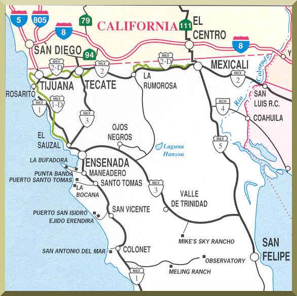
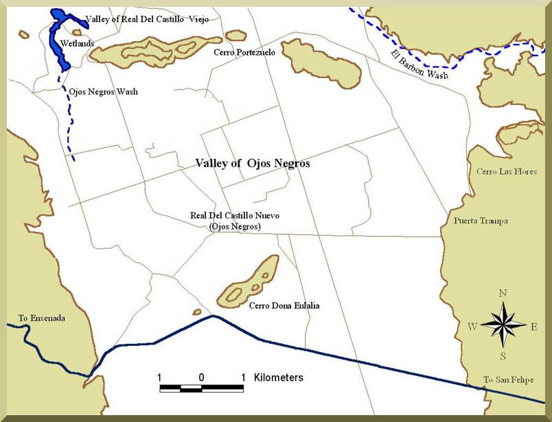
The Ojos Negros valley is located in the Real del Castillo delegation, municipality of Ensenada, Baja California, Mexico,
40 km east of the city of Ensenada and 80 km south of the U.S.-Mexico border.
-
The valley has a surface area of about 100 km2 and is completely surrounded by mountains, particularly the Sierra Juarez
to the north and east.
-
The watershed of the Ojos Negros Wash has 173 km2 and is a tributary of El Barbon Wash, which in turn is a tributary of the Rio Guadalupe.
The latter flows into the Pacific Ocean at La Mision de San Miguel Arcangel (La Mision), 42 km north of Ensenada.
- The valley is contained between 31o 52" and 31o 57" north latitude and 116o 12" and 116o 19" west longitude.
-
The land surface is relatively flat, with elevation ranging between 720 m in the northeast edge and 665 m in the northwest edge,
producing a slight slope draining toward the northwest.
-
The climate is arid and markedly seasonal, with 253 mm annual precipitation, winter rain, and frequent frost.
The wettest month is January, with 28.5% of the total rainfall; the driest month is June, with 0.55%.
- Mean annual temperature is 18.7oC. The hottest month is July, with 25.2oC; the coolest month is January, with 11.5oC.
|